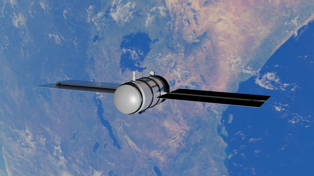
Understand how observation satellites work, the difference between optical and radar sensors, and how remote sensing is revolutionizing agricultural and forest monitoring.
What you will learn in this guide
- Fundamental Concept: What are Earth Observation (EO) satellites and how they capture data.
- Sensor Types: The practical difference between Optical and Radar (SAR) systems.
- The 4 Resolutions: Spatial, Spectral, Temporal, and Radiometric explained simply.
- Practical Applications: How to apply this data in precision agriculture and forest management.
1. What is an Earth Observation Satellite?
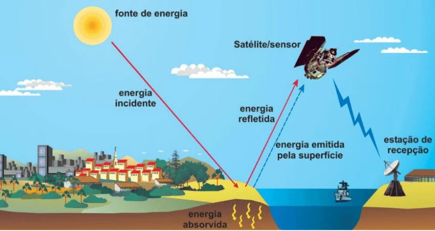
An Earth observation satellite is a space platform equipped with sensors capable of capturing information about the Earth's surface, atmosphere, and oceans without direct contact. This process is the foundation of Remote Sensing.
Unlike communication or GPS satellites, environmental satellites orbit the Earth collecting electromagnetic radiation reflected or emitted by the surface, such as visible light, infrared, and microwaves.
2. Optical vs. Radar (SAR): What's the difference?
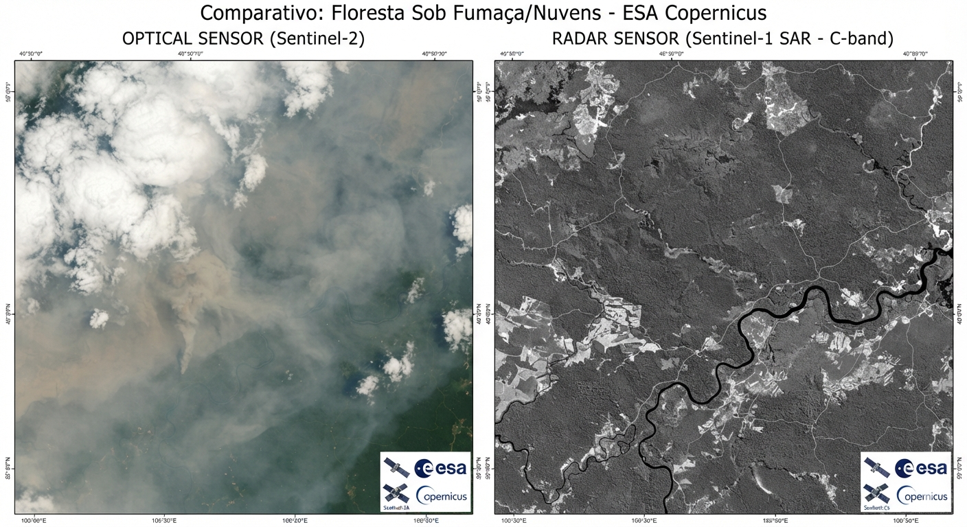
To apply remote sensing in the field, it is vital to understand the division between the two main sensor technologies:
Optical Sensors (Passive)
They depend on sunlight to illuminate the surface. They capture bands from the visible (RGB), near-infrared (NIR), and short-wave infrared (SWIR).
- Advantage: Excellent for identifying vegetation health (NDVI), land use, and water.
- Limitation: They do not penetrate clouds and do not work at night.
- Examples: Sentinel-2, Landsat 8/9, PlanetScope.
Radar / SAR Sensors (Active)
They emit their own microwave signal toward Earth and measure the backscatter that returns to the sensor.
- Advantage: They penetrate clouds, smoke, and operate day and night.
- Limitation: More complex visual interpretation (sensitive to roughness and moisture).
- Examples: Sentinel-1, ALOS-2 PALSAR.
3. The 4 Essential Resolutions
When choosing a satellite image for your project, four characteristics define its usefulness:
Spatial Resolution
The size of the smallest ground detail represented by a pixel (e.g., 10m on Sentinel-2 vs. 30cm on commercial imagery).
Spectral Resolution
The number and width of the wavelength bands (bands) that the sensor can record.
Temporal Resolution
The time interval it takes for the satellite to revisit and photograph the exact same location on Earth.
4. Applicability in Forest Management and Agriculture
Space geotechnologies are no longer exclusive to government agencies and have become daily work tools in the field:
🌳 In Forest Management
- Deforestation Mapping: Near real-time alerts of native vegetation removal.
- Fire Monitoring: Identification of heat sources and mapping of burned areas (fire scars).
- Biomass and Carbon Estimation: Carbon stock calculation for environmental offset projects and REDD+.
- Continuous Forest Inventory: Monitoring growth in commercial plantations (Eucalyptus, Pine, etc.).
🌾 In Precision Agriculture
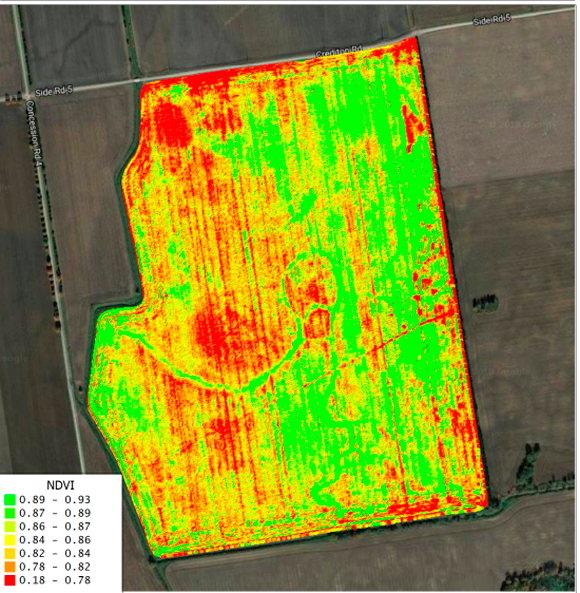
- Vegetation Indices (NDVI, EVI): Monitoring photosynthetic vigor and identifying water or nutrient stress.
- Crop Yield Forecasting: Productivity estimation before harvest.
- Land Use Mapping: Differentiation of crops (e.g., corn, soybeans, cotton) throughout the seasons.
Main Free Satellites for Professional Use
| Mission / Satellite | Agency | Spatial Resolution | Frequency (Revisit) | Main Use |
|---|---|---|---|---|
| Sentinel-2 | ESA (Europe) | 10 to 20 meters | 5 days | Vegetation, agriculture, precision agriculture. |
| Landsat 8 / 9 | NASA / USGS (USA) | 30 meters | 8 days (combined) | Historical series (since 1972), land use, and geology. |
| Sentinel-1 (Radar) | ESA (Europe) | 10 meters | 6 to 12 days | Use under clouds, fires, floods, and soil moisture. |